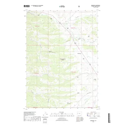
2017 Map of Bondurant
USGS Topo · Published 2017About this map
The Hoback River flows through this high-elevation landscape, carving out the dramatic Hoback Canyon and opening into the broad Hoback Basin. Centered on the community of Bondurant, the map reveals a network of canyons, draws, and ridges within the Teton National Forest. Local history is anchored at the Bondurant Cem, situated near the junction of Jack Creek Rd and the river valley. The topography is defined by significant elevation markers like Monument Ridge and Clark Butte, which oversee a complex system of seasonal drainages including Miller Draw, Clark Draw, and Horse Pasture Draw. This area serves as a critical corridor through the Wyoming wilderness, where the remote road system following the Upper Hoback River Rd and Dell Creek Rd provides the primary access to these public forest lands.
Find a feature on this map
31 named features on this map. Tap any name to fly to it.
Don’t see what you’re looking for? This feature index may not catch every label — zoom into the map to look around manually.
Map Details
Editions of this 2017 Bondurant Map
This is the sole edition of this map. No revisions or reprints were ever made.
Other maps of this area

1907 · Gros Ventre
USGS Topo · 1:125,000

1910 · Gros Ventre
USGS Topo · 1:125,000

1931 · Jackson
USGS Topo · 1:125,000

1935 · Jackson
USGS Topo · 1:125,000

1955 · Driggs
USGS Topo · 1:250,000

1958 · Driggs
USGS Topo · 1:250,000

1962 · Driggs
USGS Topo · 1:250,000
1965 · Bull Creek
USGS Topo · 1:24,000
1965 · Hoback Peak
USGS Topo · 1:24,000
1965 · Clause Peak
USGS Topo · 1:24,000