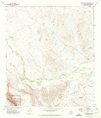
1971 Map of Bone Spring NE
USGS Topo · Published 1974About this map
Big Bend National Park extends into the southwestern corner of this survey, where the Santiago Mountains and Nine Point Draw define the topography of Brewster County. The landscape is marked by a complex network of ranching and water infrastructure, including Henderson Windmills, Shackleford Well, and Guy Lee Windmill, illustrating the critical role of groundwater in this arid environment. The presence of the Black Gap Wildlife Management Area underscores the region's managed wilderness character during the early 1970s. Arid drainage patterns are anchored by Maravillas Creek, which flows past features like Gooden Windmill. A remote Landing Strip near the creek highlights the logistical challenges and transportation methods necessary for navigating and maintaining this isolated reach of the West Texas desert.
Find a feature on this map
19 named features on this map. Tap any name to fly to it.
Don’t see what you’re looking for? This feature index may not catch every label — zoom into the map to look around manually.
Map Details
Editions of this 1971 Bone Spring NE Map
2 editions found
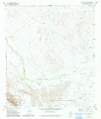
Other maps of this area

1917 · Bone Spring
USGS Topo · 1:62,500

1917 · Hood Spring
USGS Topo · 1:62,500

1918 · Bone Spring
USGS Topo · 1:125,000

1918 · Hood Spring
USGS Topo · 1:62,500

1918 · Dove Mountain
USGS Topo · 1:62,500

1918 · Bone Spring
USGS Topo · 1:62,500

1919 · Maravillas Canyon
USGS Topo · 1:62,500

1920 · Bone Spring
USGS Topo · 1:62,500

1931 · Hood Spring
USGS Topo · 1:62,500

1959 · Emory Peak
USGS Topo · 1:250,000