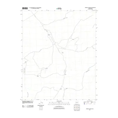
2010 Map of Bonine Canyon
USGS Topo · Published 2010About this map
Summers Ranch and a network of named water-works define this arid landscape in the early 21st century. The map illustrates a high-desert terrain deeply etched by Bonine Canyon, Tank Canyon, and Cebolla Canyon, where life and livestock management center on a series of scattered windmills. These features, including Schoolhouse Windmill, Payne Windmill, and Cox Camp Windmill, suggest the ongoing importance of groundwater access in this region of Cibola County.
Find a feature on this map
18 named features on this map. Tap any name to fly to it.
Don’t see what you’re looking for? This feature index may not catch every label — zoom into the map to look around manually.
Map Details
Editions of this 2010 Bonine Canyon Map
This is the sole edition of this map. No revisions or reprints were ever made.
Other maps of this area

1917 · Broom Mountain
USGS Topo · 1:125,000

1954 · Saint Johns
USGS Topo · 1:250,000

1954 · Socorro
USGS Topo · 1:250,000

1957 · Saint Johns
USGS Topo · 1:250,000

1958 · Socorro
USGS Topo · 1:250,000

1958 · Saint Johns
USGS Topo · 1:250,000

1962 · Socorro
USGS Topo · 1:250,000

1962 · Saint Johns
USGS Topo · 1:250,000
1964 · Sand Canyon
USGS Topo · 1:24,000
1964 · Cebollita Peak
USGS Topo · 1:24,000