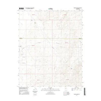
2017 Map of Bonine Canyon
USGS Topo · Published 2017About this map
Bonine Canyon and the surrounding high desert terrain define this transition point between Cibola and Catron counties. The landscape is marked by a network of drainage systems including Tank Canyon, Goat Tank Canyon, and Cebolla Canyon, which channel toward the Cebollita Cr in the southeast. While largely an unpopulated wilderness, the area is accessible through a grid of rural routes such as Catron Co Rd A079 and Elk Ridge Rd. The presence of the Pony Express Trl suggests a lineage of historic transit through these canyons, while names like Rancho Grande Lp and Maverick Rd reflect the region's enduring ranching heritage. This 2017 survey serves as a detailed record of the topography and modern access roads in a sparsely settled portion of New Mexico.
Find a feature on this map
20 named features on this map. Tap any name to fly to it.
Don’t see what you’re looking for? This feature index may not catch every label — zoom into the map to look around manually.
Map Details
Editions of this 2017 Bonine Canyon Map
This is the sole edition of this map. No revisions or reprints were ever made.
Other maps of this area

1917 · Broom Mountain
USGS Topo · 1:125,000

1954 · Saint Johns
USGS Topo · 1:250,000

1954 · Socorro
USGS Topo · 1:250,000

1957 · Saint Johns
USGS Topo · 1:250,000

1958 · Socorro
USGS Topo · 1:250,000

1958 · Saint Johns
USGS Topo · 1:250,000

1962 · Socorro
USGS Topo · 1:250,000

1962 · Saint Johns
USGS Topo · 1:250,000
1964 · Sand Canyon
USGS Topo · 1:24,000
1964 · Cebollita Peak
USGS Topo · 1:24,000