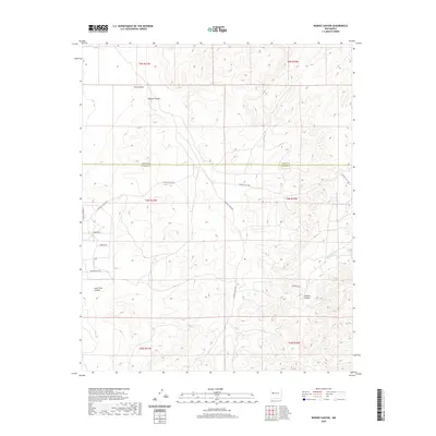
2020 Map of Bonine Canyon
USGS Topo · Published 2020About this map
Bonine Canyon and its network of drainage systems define this high-altitude landscape along the border of Cibola and Catron Counties. Recorded in 2020, the terrain is characterized by a series of significant canyons including Tank Canyon, Cebolla Canyon, and Goat Tank Canyon. The waterway of Cebolla Cr cuts through the southeastern portion of the quadrangle, reflecting the area's natural drainage patterns.
Find a feature on this map
24 named features on this map. Tap any name to fly to it.
Don’t see what you’re looking for? This feature index may not catch every label — zoom into the map to look around manually.
Map Details
Editions of this 2020 Bonine Canyon Map
This is the sole edition of this map. No revisions or reprints were ever made.
Other maps of this area

1917 · Broom Mountain
USGS Topo · 1:125,000

1954 · Saint Johns
USGS Topo · 1:250,000

1954 · Socorro
USGS Topo · 1:250,000

1957 · Saint Johns
USGS Topo · 1:250,000

1958 · Socorro
USGS Topo · 1:250,000

1958 · Saint Johns
USGS Topo · 1:250,000

1962 · Socorro
USGS Topo · 1:250,000

1962 · Saint Johns
USGS Topo · 1:250,000
1964 · Sand Canyon
USGS Topo · 1:24,000
1964 · Cebollita Peak
USGS Topo · 1:24,000