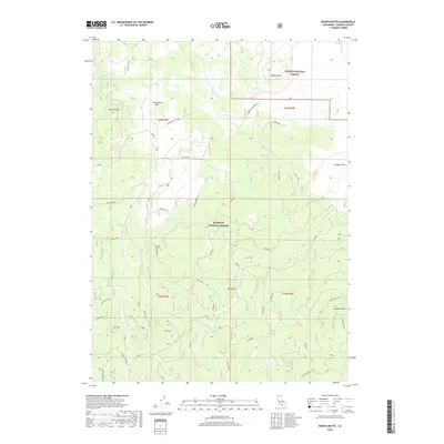
2018 Map of Bonita Butte
USGS Topo · Published 2018About this map
The high volcanic plateau of the California-Oregon border region is defined here by the intersection of the Klamath National Forest and Modoc National Forest. This remote landscape, mapped in 2018, is dominated by significant basaltic features such as the Callahan Flow and prominent volcanic peaks including Bonita Butte and the Three Sisters. A network of Forest Service roads and tracks, often bearing colorful or functional names like Absolutely Nothing, Rattle Trap, and Seed Plot Rd, provides access to this high-elevation terrain.
Find a feature on this map
53 named features on this map. Tap any name to fly to it.
Don’t see what you’re looking for? This feature index may not catch every label — zoom into the map to look around manually.
Map Details
Editions of this 2018 Bonita Butte Map
This is the sole edition of this map. No revisions or reprints were ever made.
Other maps of this area

1886 · Modoc Lava Bed
USGS Topo · 1:250,000

1892 · Modoc Lava-Bed
USGS Topo · 1:250,000

1950 · Mt. Dome
USGS Topo · 1:62,500

1950 · Bray
USGS Topo · 1:62,500

1950 · Dorris
USGS Topo · 1:62,500

1952 · Medicine Lake
USGS Topo · 1:62,500

1954 · Alturas
USGS Topo · 1:250,000

1958 · Alturas
USGS Topo · 1:250,000

1962 · Alturas
USGS Topo · 1:250,000

1965 · Alturas
USGS Topo · 1:250,000