1988 Map of Bonita Butte
USGS Topo · Published 1988About this map
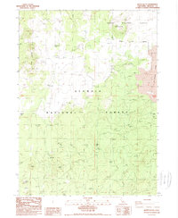
Modoc National Forest and Klamath National Forest converge in this high-altitude landscape of northern California, where volcanic geology and timber transport define the terrain. The presence of an Old Railroad Grade winding through the forest blocks suggests the area's legacy of logging, providing a clear route for researchers tracing historic industrial paths. High peaks and passes like Bonita Butte, Three Sisters, and Six Shooter Pass dominate the topography, interspersed with essential water sources such as Antelope Well and Duck Well. Industrial activity is further evidenced by a Cinder Pit and Borrow Pit, while the eastern portion of the map is marked by a prominent Lava Flow, illustrating the region's recent volcanic history near the intersection of Siskiyou and Modoc counties.
Find a feature on this map
18 named features on this map. Tap any name to fly to it.
Don’t see what you’re looking for? This feature index may not catch every label — zoom into the map to look around manually.
Map Details
Editions of this 1988 Bonita Butte Map
This is the sole edition of this map. No revisions or reprints were ever made.
Other maps of this area

1886 · Modoc Lava Bed
USGS Topo · 1:250,000

1892 · Modoc Lava-Bed
USGS Topo · 1:250,000

1950 · Mt. Dome
USGS Topo · 1:62,500

1950 · Bray
USGS Topo · 1:62,500

1950 · Dorris
USGS Topo · 1:62,500

1952 · Medicine Lake
USGS Topo · 1:62,500

1954 · Alturas
USGS Topo · 1:250,000

1958 · Alturas
USGS Topo · 1:250,000

1962 · Alturas
USGS Topo · 1:250,000

1965 · Alturas
USGS Topo · 1:250,000