
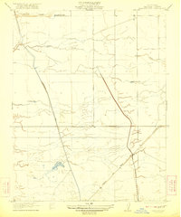
1920 Map of Bonita Ranch
USGS Topo · Published 1920About this map
The Fresno River meanders through this agricultural landscape just after the First World War, defining the character of central Madera County. The era is marked by significant hydraulic development, as seen by the concentration of water infrastructure like the Artesian Well and numerous irrigation points near Bonita Ranch. The transition of the land from open range to organized utility is evidenced by the presence of the San Joaquin Light and Power Company and established landholdings such as Rattlesnake Ranch. To the south, Cottonwood Creek flows through the alluvial plain, while the ephemeral Dry Creek cuts across the northern reaches, illustrating the seasonal water management required for the region's early 20th-century growth.
Find a feature on this map
10 named features on this map. Tap any name to fly to it.
Don’t see what you’re looking for? This feature index may not catch every label — zoom into the map to look around manually.
Map Details
Editions of this 1920 Bonita Ranch Map
This is the sole edition of this map. No revisions or reprints were ever made.
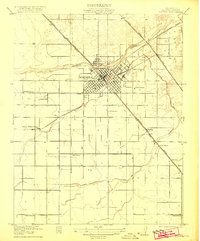
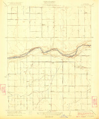
Other maps of this area

1916 · Berenda
USGS Topo · 1:31,680

1918 · Chowchilla
USGS Topo · 1:31,680

1918 · Berenda
USGS Topo · 1:31,680

1920 · Kismet
USGS Topo · 1:31,680

1921 · Mendota
USGS Topo · 1:31,680

1921 · Bonita Ranch
USGS Topo · 1:31,680
1922 · Kentucky Well
USGS Topo · 1:31,680
1922 · Madera
USGS Topo · 1:31,680
1923 · Biola
USGS Topo · 1:31,680

1924 · Gravelly Ford
USGS Topo · 1:31,680