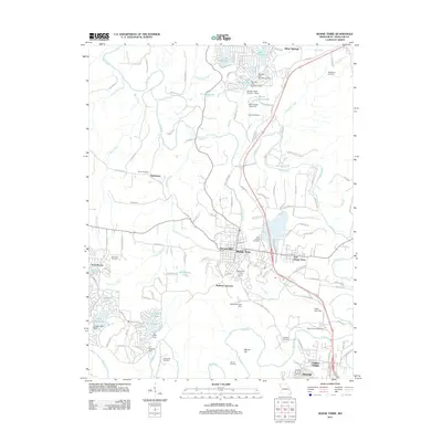
2011 Map of Bonne Terre
USGS Topo · Published 2011About this map
The Lead Belt defines this industrial and residential landscape of Saint Francois County, anchored by the city of Bonne Terre. The area is characterized by a high concentration of cemeteries, including Saint Joseph Cemetery, Appleberry Cemetery, and the uniquely named Smallpox Cemetery, providing significant points of interest for genealogists and local historians. The Big River meanders through the eastern half of the map, carving its way past St Francois State Park and supporting various tributaries like Turkey Creek and Bear Creek. To the west, the planned community of Terre Du Lac features an intricate network of streets and artificial lakes such as Lac Renee and Lac Calista. The map also documents smaller settlements and junctions like Hoffman Junction and Settletown, alongside larger population centers such as Desloge and East Bonne Terre at the southern and eastern edges.
Find a feature on this map
137 named features on this map. Tap any name to fly to it.
Don’t see what you’re looking for? This feature index may not catch every label — zoom into the map to look around manually.
Map Details
Editions of this 2011 Bonne Terre Map
This is the sole edition of this map. No revisions or reprints were ever made.
Other maps of this area

1901 · De Soto
USGS Topo · 1:125,000

1904 · Farmington
USGS Topo · 1:62,500

1905 · Bonneterre
USGS Topo · 1:62,500

1906 · Farmington
USGS Topo · 1:62,500

1915 · Crystal City
USGS Topo · 1:62,500

1931 · De Soto SE
USGS Topo · 1:24,000

1937 · Tiff
USGS Topo · 1:24,000

1939 · Tiff
USGS Topo · 1:24,000

1949 · Saint Louis
USGS Topo · 1:250,000

1949 · Rolla
USGS Topo · 1:250,000