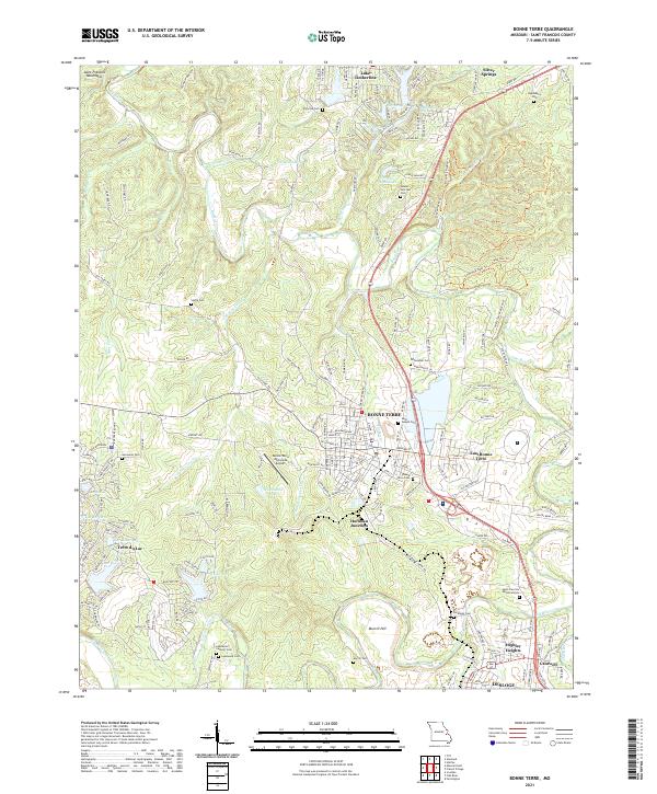
2021 Map of Bonne Terre
USGS Topo · Published 2021About this map
Bonne Terre and the surrounding mineral-rich landscape of St. Francois County are meticulously detailed in this recent survey. The area exhibits a dense concentration of local history markers, particularly seen in the numerous family and community burial grounds like Adams Hillcrest Cem, Germania Cem, and the specialized Smallpox Cem. The settlement pattern reflects the modern growth of the region, from the residential expansion of Terre du Lac to the established neighborhoods of Highley Heights and East Bonne Terre. Waterways such as Big River and Coonville Cr carve through the terrain, while the Saint Francois Mountains rise in the northwest. The presence of the Bonne Terre Municipal Airport and the proximity of Desloge and Cantwell highlight the continued importance of this area as a regional hub for transportation and commerce.
Find a feature on this map
168 named features on this map. Tap any name to fly to it.
Don’t see what you’re looking for? This feature index may not catch every label — zoom into the map to look around manually.
Map Details
Editions of this 2021 Bonne Terre Map
This is the sole edition of this map. No revisions or reprints were ever made.
Other maps of this area

1901 · De Soto
USGS Topo · 1:125,000

1904 · Farmington
USGS Topo · 1:62,500

1905 · Bonneterre
USGS Topo · 1:62,500

1906 · Farmington
USGS Topo · 1:62,500

1915 · Crystal City
USGS Topo · 1:62,500

1931 · De Soto SE
USGS Topo · 1:24,000

1937 · Tiff
USGS Topo · 1:24,000

1939 · Tiff
USGS Topo · 1:24,000

1949 · Saint Louis
USGS Topo · 1:250,000

1949 · Rolla
USGS Topo · 1:250,000