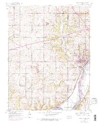
1940 Map of Bonner Springs
USGS Topo · Published 1940About this map
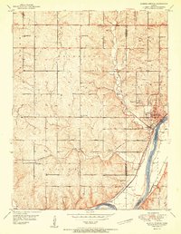
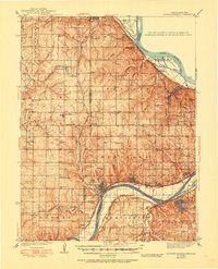
Bonner Springs and Edwardsville sit along the northern bank of the Kansas River in this 1940 edition, showing the transport corridor where the Union Pacific and Atchison Topeka and Santa Fe railroads follow the water's edge. This region, spanning the Leavenworth and Wyandotte county lines, is characterized by a dense network of rural one-room schoolhouses, including Faulkner Sch, Coffey Sch, and Virginia Sch, serving a landscape of small agricultural settlements. To the north, the Missouri River cuts past Lansing, which is marked by the presence of State Prison Camp No 2. Genealogists will find a wealth of local landmarks from the Holy Angels Cem to the Grange Hall near Zarah, while the varied terrain of High Prairie and the Little Kaw Valley illustrates the complex drainage basins of Little Stranger Cr and Ninemile Creek.
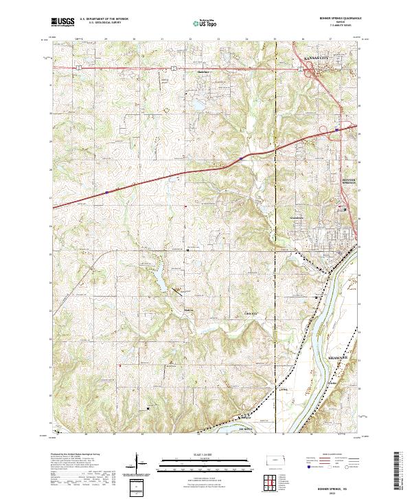
Find a feature on this map
86 named features on this map. Tap any name to fly to it.
Don’t see what you’re looking for? This feature index may not catch every label — zoom into the map to look around manually.
Map Details
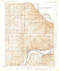
Editions of this 1940 Bonner Springs Map
3 editions found
Historical Maps of Piper Through Time
5 maps found