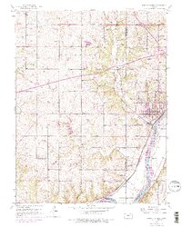
1950 Map of Bonner Springs
USGS Topo · Published 1976About this map
The Kansas River cuts through the southeastern corner of this landscape, serving as a historic boundary between Monticello and the city of Bonner Springs. In the mid-20th century, the area maintained a dense network of rural schoolhouses, including Coal Ridge Sch and Walker Sch, reflecting a distributed agrarian population before district consolidation. Transport routes define the terrain, from the industrial presence of the Union Pacific and Atchison Topeka and Santa Fe railroads to the modern path of the Kansas Turnpike (Toll Road). Cultural landmarks like Bonner Springs Cem and Riverview Cem sit near the river bluffs, while the presence of several Gas Wells and a Quarry point to the local extractive economy. The map also captures smaller communities like Loring and Frisbie, which developed alongside these vital rail and water corridors.
Find a feature on this map
36 named features on this map. Tap any name to fly to it.
Don’t see what you’re looking for? This feature index may not catch every label — zoom into the map to look around manually.
Map Details
Editions of this 1950 Bonner Springs Map
4 editions found
Other maps of this area

1885 · Lawrence
USGS Topo · 1:125,000

1886 · Oskaloosa
USGS Topo · 1:125,000

1887 · Olathe
USGS Topo · 1:125,000

1888 · Oskaloosa
USGS Topo · 1:125,000

1889 · Lawrence
USGS Topo · 1:125,000

1890 · Kansas City
USGS Topo · 1:125,000

1893 · Olathe
USGS Topo · 1:125,000

1894 · Kansas City
USGS Topo · 1:125,000

1894 · Oskaloosa
USGS Topo · 1:125,000

1934 · Bonner Springs
USGS Topo · 1:48,000