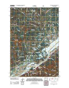
2011 Map of Bonneville Dam
USGS Topo · Published 2011About this map
The Columbia River dominates this landscape at the border of Washington and Oregon, serving as a corridor for major infrastructure including the Bonneville Dam and the Bridge of the Gods. This survey documents the complex geography of the Columbia River Gorge, where river islands like Bradford Island, Cascades Island, and Robins Island are integrated into the hydroelectric and navigation systems. On the Washington side, the town of Stevenson and the planned community of North Bonneville sit near the water's edge, while the terrain rises sharply toward Greenleaf Peak and Rock Creek Butte. The map provides significant detail for local historians, showing the location of Fort Rains and family-named sites such as Iman Cemetery. Transportation and industry are highlighted by the presence of the Cascade Salmon Hatchery, the Tooth Rock Tunnel, and the Cascade Locks-Stevenson State Airport, illustrating how the gorge has been adapted for power, transit, and conservation.
Find a feature on this map
108 named features on this map. Tap any name to fly to it.
Don’t see what you’re looking for? This feature index may not catch every label — zoom into the map to look around manually.
Map Details
Editions of this 2011 Bonneville Dam Map
This is the sole edition of this map. No revisions or reprints were ever made.
Other maps of this area

1926 · Hood River
USGS Topo · 1:125,000

1929 · Hood River
USGS Topo · 1:125,000

1940 · Lookout Mtn
USGS Topo · 1:62,500

1948 · Vancouver
USGS Topo · 1:250,000

1950 · Vancouver
USGS Topo · 1:250,000

1950 · Vancouver
USGS Topo · 1:250,000

1953 · Lookout Mtn
USGS Topo · 1:62,500

1953 · The Dalles
USGS Topo · 1:250,000

1954 · Bridal Veil
USGS Topo · 1:62,500

1956 · The Dalles
USGS Topo · 1:250,000