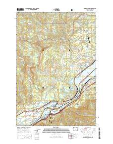
2014 Map of Bonneville Dam
USGS Topo · Published 2014About this map
Bonneville Dam anchors this study of the Columbia River Gorge, where the engineered structure spans the state line between Washington and Oregon. This 2014 survey documents the complex geography of the river's path, including Bradford Island and Cascades Island at the dam site, and the high-elevation terrain of Gifford Pinchot National Forest to the north. Local history is preserved in the location of the Iman Cem near Stevenson and the Freddie Masterson Grave in Cascade Locks. The map highlights the transit corridor through the gorge, featuring the Bridge of the Gods and the Toothrock Tunnel. Diverse water bodies such as Gillette Lake and Ashes Lake are visible along the river's northern banks, while the Pacific Crest National Scenic Trail winds through the forested bluffs and past landmarks like Sacagawea and Papoose Rocks.
Find a feature on this map
107 named features on this map. Tap any name to fly to it.
Don’t see what you’re looking for? This feature index may not catch every label — zoom into the map to look around manually.
Map Details
Editions of this 2014 Bonneville Dam Map
This is the sole edition of this map. No revisions or reprints were ever made.
Other maps of this area

1926 · Hood River
USGS Topo · 1:125,000

1929 · Hood River
USGS Topo · 1:125,000

1940 · Lookout Mtn
USGS Topo · 1:62,500

1948 · Vancouver
USGS Topo · 1:250,000

1950 · Vancouver
USGS Topo · 1:250,000

1950 · Vancouver
USGS Topo · 1:250,000

1953 · Lookout Mtn
USGS Topo · 1:62,500

1953 · The Dalles
USGS Topo · 1:250,000

1954 · Bridal Veil
USGS Topo · 1:62,500

1956 · The Dalles
USGS Topo · 1:250,000