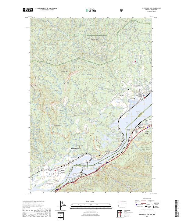
2024 Map of Bonneville Dam
USGS Topo · Published 2024About this map
Stevenson and North Bonneville anchor this map of the Columbia River Gorge, where industrial infrastructure meets protected wilderness. The river serves as both a boundary and a corridor, featuring the Bonneville Lock and a network of islands including Bradford Island and Cascades Island. The landscape is dominated by steep terrain such as Greenleaf Peak and Rock Creek Butte, while the BNSF Railway tracks the northern bank. Local history is preserved in sites like Iman Cem and the Freddie Masterson Grave, providing specific touchpoints for genealogical research. The map also captures the confluence of major trail systems, including the Pacific Crest National Scenic Trl and Gorge Trl, which navigate the slopes between Gifford Pinchot National Forest and the Mark O Hatfield Wilderness.
Find a feature on this map
115 named features on this map. Tap any name to fly to it.
Don’t see what you’re looking for? This feature index may not catch every label — zoom into the map to look around manually.
Map Details
Editions of this 2024 Bonneville Dam Map
This is the sole edition of this map. No revisions or reprints were ever made.
Other maps of this area

1926 · Hood River
USGS Topo · 1:125,000

1929 · Hood River
USGS Topo · 1:125,000

1940 · Lookout Mtn
USGS Topo · 1:62,500

1948 · Vancouver
USGS Topo · 1:250,000

1950 · Vancouver
USGS Topo · 1:250,000

1950 · Vancouver
USGS Topo · 1:250,000

1953 · Lookout Mtn
USGS Topo · 1:62,500

1953 · The Dalles
USGS Topo · 1:250,000

1954 · Bridal Veil
USGS Topo · 1:62,500

1956 · The Dalles
USGS Topo · 1:250,000