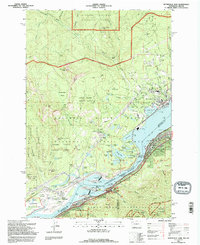
1994 Map of Bonneville Dam
USGS Topo · Published 1996About this map
Bonneville Dam anchors this mid-1990s survey of the Columbia River Gorge, where the massive engineering of the powerhouse and spillways sits alongside the established riverfront communities of Stevenson, Cascade Locks, and North Bonneville. The landscape is a study in 20th-century transportation and energy infrastructure, featuring the iconic Bridge of the Gods spanning the river between Washington and Oregon, and the Union Pacific railroad tracks following the southern shore. Steep elevations rise sharply from the water toward Greenleaf Peak and Table Mtn, while the Pacific Crest National Scenic Trail winds through the Gifford Pinchot National Forest. Local history is preserved in landmarks such as the Iman Cem near Rock Cove and the recreational grounds of the Beacon Rock Golf Course, illustrating the balance between industrial utility and public land preservation in this critical river corridor.
Find a feature on this map
82 named features on this map. Tap any name to fly to it.
Don’t see what you’re looking for? This feature index may not catch every label — zoom into the map to look around manually.
Map Details
Editions of this 1994 Bonneville Dam Map
This is the sole edition of this map. No revisions or reprints were ever made.
Other maps of this area

1926 · Hood River
USGS Topo · 1:125,000

1929 · Hood River
USGS Topo · 1:125,000

1940 · Lookout Mtn
USGS Topo · 1:62,500

1948 · Vancouver
USGS Topo · 1:250,000

1950 · Vancouver
USGS Topo · 1:250,000

1950 · Vancouver
USGS Topo · 1:250,000

1953 · Lookout Mtn
USGS Topo · 1:62,500

1953 · The Dalles
USGS Topo · 1:250,000

1954 · Bridal Veil
USGS Topo · 1:62,500

1956 · The Dalles
USGS Topo · 1:250,000