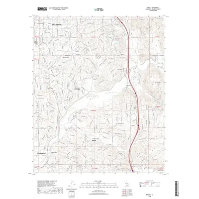
2018 Map of Bonsall
USGS Topo · Published 2018About this map
Bonsall and the northern reaches of Oceanside define this inland San Diego County landscape, where the San Luis Rey River carves a path through a series of canyons and mountain peaks. The map reveals a suburban and agricultural network spanning from the Fallbrook Community Airpark down through San Luis Rey Heights and Winterwarm. Key infrastructure is evident in the path of the Second San Diego Aqueduct and the engineering of the West/Lilac Bridge crossing the Interstate.
Find a feature on this map
59 named features on this map. Tap any name to fly to it.
Don’t see what you’re looking for? This feature index may not catch every label — zoom into the map to look around manually.
Map Details
Editions of this 2018 Bonsall Map
This is the sole edition of this map. No revisions or reprints were ever made.
Other maps of this area

1893 · Oceanside
USGS Topo · 1:62,500

1893 · Escondido
USGS Topo · 1:62,500

1898 · Oceanside
USGS Topo · 1:62,500

1901 · Escondido
USGS Topo · 1:62,500

1901 · Oceanside
USGS Topo · 1:62,500

1901 · San Luis Rey
USGS Topo · 1:125,000

1904 · Southern California Sheet No. 2
USGS Topo · 1:250,000

1941 · Margarita Peak
USGS Topo · 1:62,500

1942 · Margarita Peak
USGS Topo · 1:62,500

1942 · Temecula
USGS Topo · 1:62,500