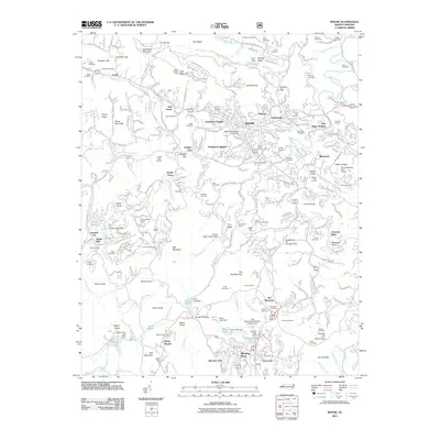
2011 Map of Boone
USGS Topo · Published 2011About this map
Appalachian State University anchors the High Country landscape, surrounded by a complex network of mountain settlements and family landmarks. This 2011 survey illustrates the development of Boone and Blowing Rock as tourism and education hubs, linked by Us 321. The map reveals a dense distribution of family burial grounds, such as Adams Cemetery, Hollars Cemetery, and Moretz Cemetery, which provide critical reference points for local genealogists. Industrial activity is noted at Hodges Gap Quarry and Bamboo Quarry, while recreational and historical sites like the Daniel Boone Theater and Camp Sky Ranch reflect the area’s identity as a destination. Notable water features, including Price Lake and Chetola Lake, are detailed alongside significant elevation markers like Howard Knob and Rich Mountain.
Find a feature on this map
145 named features on this map. Tap any name to fly to it.
Don’t see what you’re looking for? This feature index may not catch every label — zoom into the map to look around manually.
Map Details
Editions of this 2011 Boone Map
This is the sole edition of this map. No revisions or reprints were ever made.
Other maps of this area

1893 · Cranberry
USGS Topo · 1:125,000

1895 · Cranberry
USGS Topo · 1:125,000

1899 · Cranberry
USGS Topo · 1:125,000

1902 · Cranberry
USGS Topo · 1:125,000

1934 · Valle Crucis
USGS Topo · 1:24,000

1934 · Boone
USGS Topo · 1:24,000

1935 · Doe Mountain
USGS Topo · 1:48,000

1935 · Sherwood
USGS Topo · 1:24,000

1935 · Zionville
USGS Topo · 1:24,000

1936 · Blowing Rock
USGS Topo · 1:48,000