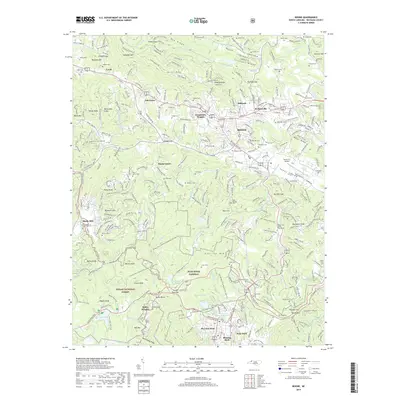
2019 Map of Boone
USGS Topo · Published 2019About this map
Boone and Blowing Rock anchor this high-elevation terrain, where the crest of the Blue Ridge Mountains shapes both the hydrology and the historic transport networks. The Blue Ridge Parkway winds through the landscape, connecting recreation areas like Price Lake, Bass Lake, and Trout Lake within the Pisgah National Forest. The map documents a complex web of modern roads and historic carriage trails, such as the Rich Mountain Carriage Trail and the Maze Carriage Trail, which reflect the area's legacy as a premier mountain retreat. Notable for genealogists, the survey identifies dozens of family-named burial grounds, including Adams, Vannoy, and Edmisten cemeteries. Between the settlements of Perkinsville and Shulls Mill, the headwaters of the South Fork New River and the Watauga River define the local topography.
Find a feature on this map
119 named features on this map. Tap any name to fly to it.
Don’t see what you’re looking for? This feature index may not catch every label — zoom into the map to look around manually.
Map Details
Editions of this 2019 Boone Map
This is the sole edition of this map. No revisions or reprints were ever made.
Other maps of this area

1893 · Cranberry
USGS Topo · 1:125,000

1895 · Cranberry
USGS Topo · 1:125,000

1899 · Cranberry
USGS Topo · 1:125,000

1902 · Cranberry
USGS Topo · 1:125,000

1934 · Valle Crucis
USGS Topo · 1:24,000

1934 · Boone
USGS Topo · 1:24,000

1935 · Doe Mountain
USGS Topo · 1:48,000

1935 · Sherwood
USGS Topo · 1:24,000

1935 · Zionville
USGS Topo · 1:24,000

1936 · Blowing Rock
USGS Topo · 1:48,000