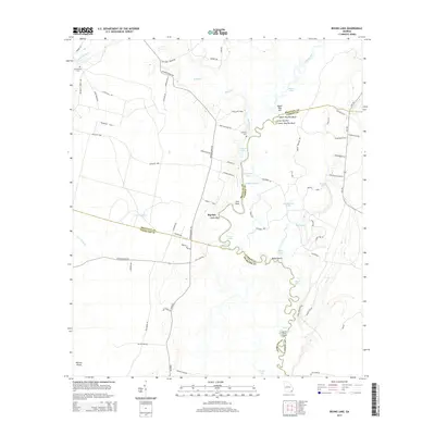
2014 Map of Boons Lake
USGS Topo · Published 2014About this map
The Satilla River meanders through the heart of this coastal Georgia landscape, forming a complex network of wetlands and oxbows at the convergence of Brantley, Camden, and Charlton Counties. This 2014 survey documents a region defined by its water-bound geography, where named bluffs like Upper Hog Pen Bluff and Big Oak Oquin Bluff overlook the winding river channel. The river's path is marked by distinctive features such as Knee Buckle and the Buffalo Reaches, creating a labyrinthine environment of islands and lakes including Blues Island and Boons Lake. Away from the riverbanks, the terrain transitions into the expansive Cross Swamp. Settlement is sparse, characterized by rural homesteads and agricultural operations like Creek View Farms, while local history is preserved at the Bethlehem Cem and Dowling Cem. The map provides a detailed look at the local road network, including the Wainright Loop and Riverside Rock Rd, which connect these isolated landings and rural communities.
Find a feature on this map
80 named features on this map. Tap any name to fly to it.
Don’t see what you’re looking for? This feature index may not catch every label — zoom into the map to look around manually.
Map Details
Editions of this 2014 Boons Lake Map
This is the sole edition of this map. No revisions or reprints were ever made.
Other maps of this area

1917 · Nahunta
USGS Topo · 1:62,500

1917 · Boulogne
USGS Topo · 1:62,500

1918 · Folkston
USGS Topo · 1:62,500

1918 · Nahunta
USGS Topo · 1:62,500

1919 · Boulogne
USGS Topo · 1:62,500

1946 · Brunswick
USGS Topo · 1:250,000

1948 · Jacksonville
USGS Topo · 1:250,000

1948 · Brunswick
USGS Topo · 1:250,000

1953 · Waycross
USGS Topo · 1:250,000

1954 · Valdosta
USGS Topo · 1:250,000