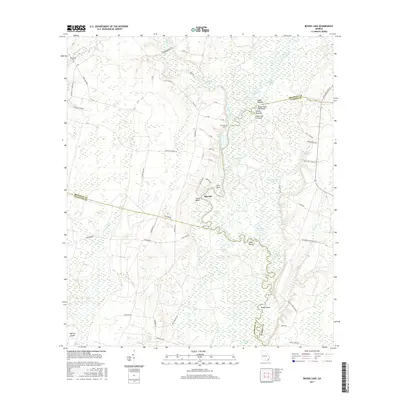
2017 Map of Boons Lake
USGS Topo · Published 2017About this map
The Satilla River meanders through a landscape of dense wetlands and riverine features where Brantley, Charlton, and Camden counties meet. This coastal plain environment is defined by its complex hydrology, featuring numerous named oxbows and reaches such as Boons Lake, Teston Lake, and the Buffalo Reaches. The topography is marked by distinct river bluffs and elevated landforms, including Upper Hog Pen Bluff, Lower Hog Pen Bluff, and Oquin Bluff, which overlook the surrounding swampy terrain. Small family and community landmarks like Bethlehem Cem and Dowling Cem suggest the long-standing local ties to the land near the settlement of Big Oak. The extensive network of local roads and logging routes, such as Gate Logging Rd and Bachlott Church Rd, highlights the area's history of timber harvesting and rural connectivity within the Cross Swamp region.
Find a feature on this map
78 named features on this map. Tap any name to fly to it.
Don’t see what you’re looking for? This feature index may not catch every label — zoom into the map to look around manually.
Map Details
Editions of this 2017 Boons Lake Map
This is the sole edition of this map. No revisions or reprints were ever made.
Other maps of this area

1917 · Nahunta
USGS Topo · 1:62,500

1917 · Boulogne
USGS Topo · 1:62,500

1918 · Folkston
USGS Topo · 1:62,500

1918 · Nahunta
USGS Topo · 1:62,500

1919 · Boulogne
USGS Topo · 1:62,500

1946 · Brunswick
USGS Topo · 1:250,000

1948 · Jacksonville
USGS Topo · 1:250,000

1948 · Brunswick
USGS Topo · 1:250,000

1953 · Waycross
USGS Topo · 1:250,000

1954 · Valdosta
USGS Topo · 1:250,000