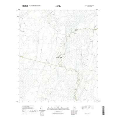
2020 Map of Boons Lake
USGS Topo · Published 2020About this map
The Satilla River carves a winding path through this low-lying landscape along the borders of Brantley, Charlton, and Camden Counties. The settlement of Big Oak stands near the riverbank, serving as a focal point in a region defined by extensive wetlands like Cross Swamp and the broad expanse of Big Bay. The river's influence is evident in the numerous named bluffs and bends that provided landmarks for locals and travelers alike, including Upper Hog Pen Bluff, Lower Hog Pen Bluff, and the sharp turn known as Knee Buckle.
Find a feature on this map
80 named features on this map. Tap any name to fly to it.
Don’t see what you’re looking for? This feature index may not catch every label — zoom into the map to look around manually.
Map Details
Editions of this 2020 Boons Lake Map
This is the sole edition of this map. No revisions or reprints were ever made.
Other maps of this area

1917 · Nahunta
USGS Topo · 1:62,500

1917 · Boulogne
USGS Topo · 1:62,500

1918 · Folkston
USGS Topo · 1:62,500

1918 · Nahunta
USGS Topo · 1:62,500

1919 · Boulogne
USGS Topo · 1:62,500

1946 · Brunswick
USGS Topo · 1:250,000

1948 · Jacksonville
USGS Topo · 1:250,000

1948 · Brunswick
USGS Topo · 1:250,000

1953 · Waycross
USGS Topo · 1:250,000

1954 · Valdosta
USGS Topo · 1:250,000