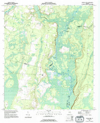
1993 Map of Boons Lake
USGS Topo · Published 1995About this map
The Satilla River carves a winding path through this corner of Georgia, where Brantley, Camden, and Charlton counties converge. The landscape is defined by an intricate network of river-fed basins and swampy lowlands, including the wide expanse of Big Bay and numerous oxbow lakes such as Boons Lake, Tesion Lake, and Santee Lake. This 1993 revision shows a region largely characterized by its hydrology and isolated landforms like Blues Island and Warren Island, where natural elevation rises above the floodplain.
Find a feature on this map
31 named features on this map. Tap any name to fly to it.
Don’t see what you’re looking for? This feature index may not catch every label — zoom into the map to look around manually.
Map Details
Editions of this 1993 Boons Lake Map
This is the sole edition of this map. No revisions or reprints were ever made.
Other maps of this area

1917 · Nahunta
USGS Topo · 1:62,500

1917 · Boulogne
USGS Topo · 1:62,500

1918 · Folkston
USGS Topo · 1:62,500

1918 · Nahunta
USGS Topo · 1:62,500

1919 · Boulogne
USGS Topo · 1:62,500

1946 · Brunswick
USGS Topo · 1:250,000

1948 · Jacksonville
USGS Topo · 1:250,000

1948 · Brunswick
USGS Topo · 1:250,000

1953 · Waycross
USGS Topo · 1:250,000

1954 · Valdosta
USGS Topo · 1:250,000