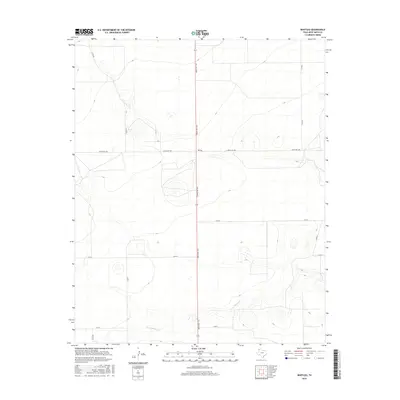
2016 Map of Bootleg
USGS Topo · Published 2016About this map
Bootleg anchors this section of the Texas Panhandle in Deaf Smith County, situated at the junction of Ranch Rd 1058 and Ranch Rd 1412. The landscape is defined by the high plains' characteristic grid of rural routes, including Co Rd RR and Co Rd Q, which provide access to large-scale agricultural tracts. The terrain is marked by subtle drainage patterns, most notably along Tierra Blanca Cr in the southern portion of the map. This area represents the traditional ranching and farming heritage of the region, where water sources like the creek were historically vital for livestock. The 2016 survey illustrates the persistent geometry of West Texas land management, showing how modern transportation corridors like Ranch Rd 1412 bisect the open country to connect these isolated rural communities.
Find a feature on this map
10 named features on this map. Tap any name to fly to it.
Don’t see what you’re looking for? This feature index may not catch every label — zoom into the map to look around manually.
Map Details
Editions of this 2016 Bootleg Map
This is the sole edition of this map. No revisions or reprints were ever made.
Other maps of this area

1954 · Clovis
USGS Topo · 1:250,000

1958 · Clovis
USGS Topo · 1:250,000

1965 · Twin Lakes
USGS Topo · 1:24,000

1965 · Rhea
USGS Topo · 1:24,000

1966 · Friona
USGS Topo · 1:24,000

1970 · Chalk Hill
USGS Topo · 1:24,000

1971 · Mustang Lake
USGS Topo · 1:24,000

1971 · Bootleg
USGS Topo · 1:24,000

1971 · Garcia Lake
USGS Topo · 1:24,000
1971 · Westway NW
USGS Topo · 1:24,000