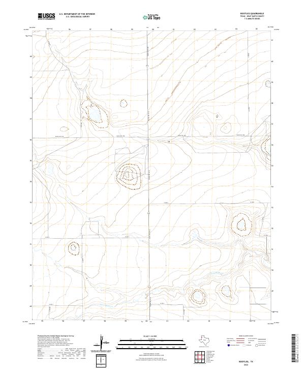
2022 Map of Bootleg
USGS Topo · Published 2022About this map
Tierra Blanca Cr winds through this section of Deaf Smith County, carving a subtle path across the High Plains landscape. The map illustrates a strictly organized agricultural grid, where ranch roads and county routes define the modern boundaries of the Texas Panhandle. This systematic division of land is anchored by Ranch Rd 1412 and Ranch Rd 1058, which intersect to facilitate the movement of goods and livestock across the plains. The sparse placement of named features highlights the expansive nature of the region, where the terrain is shaped more by these transport arteries and the intermittent flow of the creek than by concentrated settlements. Researchers of local land use can see how the road network, including Co Rd RR and Co Rd Q, creates the large-scale parcels characteristic of contemporary West Texas ranching and farming operations.
Find a feature on this map
9 named features on this map. Tap any name to fly to it.
Don’t see what you’re looking for? This feature index may not catch every label — zoom into the map to look around manually.
Map Details
Editions of this 2022 Bootleg Map
This is the sole edition of this map. No revisions or reprints were ever made.
Other maps of this area

1954 · Clovis
USGS Topo · 1:250,000

1958 · Clovis
USGS Topo · 1:250,000

1965 · Twin Lakes
USGS Topo · 1:24,000

1965 · Rhea
USGS Topo · 1:24,000

1966 · Friona
USGS Topo · 1:24,000

1970 · Chalk Hill
USGS Topo · 1:24,000

1971 · Mustang Lake
USGS Topo · 1:24,000

1971 · Bootleg
USGS Topo · 1:24,000

1971 · Garcia Lake
USGS Topo · 1:24,000
1971 · Westway NW
USGS Topo · 1:24,000