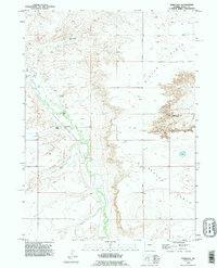
1990 Map of Bordeaux
USGS Topo · Published 1995About this map
Bordeaux serves as a focal point in this Platte County landscape, where the meandering course of Chugwater Creek defines the local topography. This 1990 revision reflects a region deeply rooted in livestock operations, evidenced by family-named landmarks like the Phillips Ranch, L D Ranch, and M Bar Ranch. The terrain transitions from the level expanses of Slater Flats toward the more complex elevations of the Goshen Hole Rim, revealing the geological margins of the area.
Find a feature on this map
14 named features on this map. Tap any name to fly to it.
Don’t see what you’re looking for? This feature index may not catch every label — zoom into the map to look around manually.
Map Details
Editions of this 1990 Bordeaux Map
This is the sole edition of this map. No revisions or reprints were ever made.
Other maps of this area

1896 · Hartville
USGS Topo · 1:125,000

1901 · Hartville
USGS Topo · 1:125,000

1951 · Antelope Gap
USGS Topo · 1:24,000
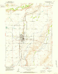
1951 · Wheatland
USGS Topo · 1:24,000

1951 · Eagles Nest
USGS Topo · 1:24,000

1953 · Double L Ranch
USGS Topo · 1:24,000

1953 · Chugwater
USGS Topo · 1:24,000

1953 · Ferguson Corner
USGS Topo · 1:24,000

1953 · Bordeaux
USGS Topo · 1:24,000

1954 · Torrington
USGS Topo · 1:250,000