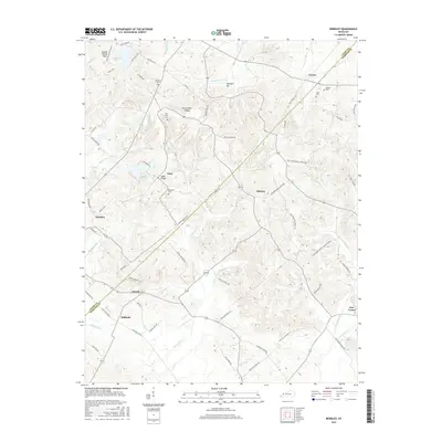
2016 Map of Bordley
USGS Topo · Published 2016About this map
Bordley and Shelton anchor a rural landscape defined by narrow ridges and winding creek valleys along the Union Co Webster Co line. Long-established family ties are visible in the numerous small burial grounds marking the hillsides, including Holeman Cem, Oak Grove Cem, and Richards Cem. The terrain is shaped by the Sulphur Spring Hills and the prominent height of Springer Hill, with local drainage flowing through systems like Caney Fork and Sugarcamp Cr. Small settlements such as Yuba and Givens are connected by a network of named country roads, reflecting the agricultural and residential patterns of the early twenty-first century. Water features like Cap Mauzy Lake and Moffit Lake punctuate the northern sections, while drainage ditches like Bishop Ditch indicate managed land use in the lower elevations.
Find a feature on this map
72 named features on this map. Tap any name to fly to it.
Don’t see what you’re looking for? This feature index may not catch every label — zoom into the map to look around manually.
Map Details
Editions of this 2016 Bordley Map
This is the sole edition of this map. No revisions or reprints were ever made.
Other maps of this area

1906 · Sebree
USGS Topo · 1:62,500

1907 · Earlington
USGS Topo · 1:48,000

1907 · Morganfield
USGS Topo · 1:62,500

1909 · Earlington
USGS Topo · 1:62,500

1909 · Providence
USGS Topo · 1:62,500

1949 · Morganfield
USGS Topo · 1:24,000

1949 · Poole
USGS Topo · 1:24,000

1951 · Dixon
USGS Topo · 1:24,000

1951 · Poole
USGS Topo · 1:24,000

1951 · Waverly
USGS Topo · 1:24,000