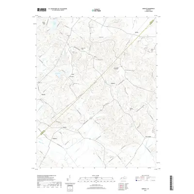
2019 Map of Bordley
USGS Topo · Published 2019About this map
Sulphur Spring Hills and Springer Hill rise above the rolling landscape of Webster and Union counties, where small rural settlements like Shelton and Bordley anchor a network of country roads. The map reveals a high concentration of small family and community burial grounds, such as Holeman Cem and Richards Cem, which are essential for genealogical research in this part of Kentucky. Industrial activity is represented by the Load Star Energy facility near Hearin, contrasting with the more traditional agricultural and wooded areas along Caney Fork. Significant water features include Cap Mauzy Lake and the Bordley Ditch, which indicate historical efforts to manage the local drainage. These details, along with established ridges like Persimmon Ridge and Yuba Ridge, illustrate the persistent intersection of the region's topography with its long-standing farming and energy-producing communities.
Find a feature on this map
83 named features on this map. Tap any name to fly to it.
Don’t see what you’re looking for? This feature index may not catch every label — zoom into the map to look around manually.
Map Details
Editions of this 2019 Bordley Map
This is the sole edition of this map. No revisions or reprints were ever made.
Other maps of this area

1906 · Sebree
USGS Topo · 1:62,500

1907 · Earlington
USGS Topo · 1:48,000

1907 · Morganfield
USGS Topo · 1:62,500

1909 · Earlington
USGS Topo · 1:62,500

1909 · Providence
USGS Topo · 1:62,500

1949 · Morganfield
USGS Topo · 1:24,000

1949 · Poole
USGS Topo · 1:24,000

1951 · Dixon
USGS Topo · 1:24,000

1951 · Poole
USGS Topo · 1:24,000

1951 · Waverly
USGS Topo · 1:24,000