
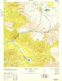
1942 Map of Borego
USGS Topo · Published 1943About this map
The Borego Valley corridor and its surrounding desert peaks are captured here just as World War II-era mapping efforts refined the understanding of this arid landscape. This 1942 road survey highlights the intersection of modern travel and pioneer history at Scissors Crossing, where the Old Overland Stage Route cuts through Earthquake Valley toward the Las Arena Ranch. The transition from the high Oriflamme Mountains to the low Borrego Sink illustrates the importance of water in this environment, anchored by the Yaqui Well and the remote Borrego Spring.
Find a feature on this map
37 named features on this map. Tap any name to fly to it.
Don’t see what you’re looking for? This feature index may not catch every label — zoom into the map to look around manually.
Map Details
Editions of this 1942 Borego Map
2 editions found
Other maps of this area

1903 · Cuyamaca
USGS Topo · 1:125,000

1903 · Ramona
USGS Topo · 1:125,000

1904 · Indio
USGS Topo · 1:125,000

1904 · Southern California Sheet No. 2
USGS Topo · 1:250,000

1931 · Vallecito
USGS Topo · 1:125,000

1931 · Carrizo
USGS Topo · 1:125,000

1939 · Warner Springs
USGS Topo · 1:62,500

1939 · Santa Ysabel
USGS Topo · 1:62,500

1939 · Borrego
USGS Topo · 1:62,500

1941 · Clark Lake
USGS Topo · 1:62,500