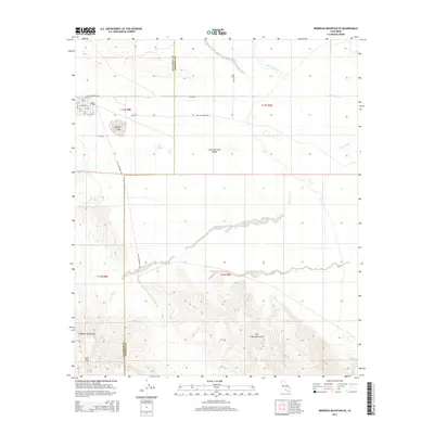
2015 Map of Borrego Mountain SE
USGS Topo · Published 2015About this map
Little Borrego sits at the northwestern edge of this 2015 survey, where a grid of streets including Broadway and Main ST meets the open desert. The landscape is defined by the transition from the arid floor of the Lower Borrego Valley to the surrounding peaks. The Vallecito Mountains rise in the southwest, while the Fish Creek Mountains dominate the southeastern quadrant. This topography creates a complex network of drainage features, including the braided paths of Fish Cr Wash, Alma Wash, and San Felipe Cr.
Find a feature on this map
30 named features on this map. Tap any name to fly to it.
Don’t see what you’re looking for? This feature index may not catch every label — zoom into the map to look around manually.
Map Details
Editions of this 2015 Borrego Mountain SE Map
This is the sole edition of this map. No revisions or reprints were ever made.
Other maps of this area

1915 · El Centro
USGS Topo · 1:125,000

1931 · Vallecito
USGS Topo · 1:125,000

1931 · Carrizo
USGS Topo · 1:125,000

1940 · Kane Spring
USGS Topo · 1:62,500

1940 · Plaster City
USGS Topo · 1:62,500

1942 · Barrel Spring
USGS Topo · 1:62,500

1942 · El Centro
USGS Topo · 1:250,000

1942 · Carrizo Mtn
USGS Topo · 1:62,500

1943 · Vallecito
USGS Topo · 1:125,000

1944 · Plaster City
USGS Topo · 1:62,500