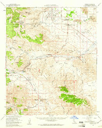
1959 Map of Borrego
USGS Topo · Published 1961About this map
Borrego Springs serves as the central hub of this desert landscape, where the early infrastructure of the Anza-Borrego Desert State Park is documented alongside remnants of much older travel corridors. The presence of the Old Overland Stage Route and the San Felipe-Butterfield Stage Station Historical Marker highlights the area's significance as a historic passage through the Vallecito Mountains.
Find a feature on this map
87 named features on this map. Tap any name to fly to it.
Don’t see what you’re looking for? This feature index may not catch every label — zoom into the map to look around manually.
Map Details
Editions of this 1959 Borrego Map
3 editions found
Other maps of this area

1903 · Cuyamaca
USGS Topo · 1:125,000

1903 · Ramona
USGS Topo · 1:125,000

1904 · Indio
USGS Topo · 1:125,000

1904 · Southern California Sheet No. 2
USGS Topo · 1:250,000

1931 · Vallecito
USGS Topo · 1:125,000

1931 · Carrizo
USGS Topo · 1:125,000

1939 · Warner Springs
USGS Topo · 1:62,500

1939 · Santa Ysabel
USGS Topo · 1:62,500

1939 · Borrego
USGS Topo · 1:62,500

1941 · Clark Lake
USGS Topo · 1:62,500