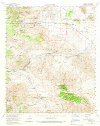
1959 Map of Borrego
USGS Topo · Published 1966About this map
Anza-Borrego Desert State Park encompasses the majority of this desert landscape, where the shifting sands of Borrego Sink meet the high ridges of the Vallecito Mountains. This mid-century survey documents a transition from the historic western trails to modern recreation, centered around the development of Borrego Springs and the Ensign Ranch Airstrip. Traces of the mid-19th century remain visible through the Old Overland Stage Route and the San Felipe-Butterfield Stage Station Historical Marker in the Valle De San Felipe. The map captures a reliable network of desert water sources essential for early travel, from Maidenhair Falls in Hellhole Canyon to Angelina Spring. Landmarks like Chimney Rock Ranch and the Blair Valley Ranger Sta highlight the human presence amidst the peaks of Whale Peak and Granite Mtn.
Find a feature on this map
72 named features on this map. Tap any name to fly to it.
Don’t see what you’re looking for? This feature index may not catch every label — zoom into the map to look around manually.
Map Details
Editions of this 1959 Borrego Map
3 editions found
Other maps of this area

1903 · Cuyamaca
USGS Topo · 1:125,000

1903 · Ramona
USGS Topo · 1:125,000

1904 · Indio
USGS Topo · 1:125,000

1904 · Southern California Sheet No. 2
USGS Topo · 1:250,000

1931 · Vallecito
USGS Topo · 1:125,000

1931 · Carrizo
USGS Topo · 1:125,000

1939 · Warner Springs
USGS Topo · 1:62,500

1939 · Santa Ysabel
USGS Topo · 1:62,500

1939 · Borrego
USGS Topo · 1:62,500

1941 · Clark Lake
USGS Topo · 1:62,500