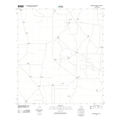
2010 Map of Borregos Ranch
USGS Topo · Published 2010About this map
Borregos Ranch and a dense network of family-named windmills define this arid landscape in South Texas. This 2010 survey illustrates the continued importance of groundwater infrastructure for cattle ranching, with dozens of named points like Sufrimiento Windmill, Charco Nuevo Windmill, and Mirasoles Windmill distributed across the terrain. These landmarks often represent historic family holdings or specific pasture locations, providing valuable data for genealogists tracing local land use.
Find a feature on this map
28 named features on this map. Tap any name to fly to it.
Don’t see what you’re looking for? This feature index may not catch every label — zoom into the map to look around manually.
Map Details
Editions of this 2010 Borregos Ranch Map
This is the sole edition of this map. No revisions or reprints were ever made.
Other maps of this area

1938 · El Sauz
USGS Topo · 1:62,500

1938 · Agua Nueva
USGS Topo · 1:62,500

1938 · Sal Colorada
USGS Topo · 1:62,500

1938 · Cuevitas
USGS Topo · 1:62,500

1949 · Mc Allen
USGS Topo · 1:250,000

1954 · McAllen
USGS Topo · 1:250,000

1957 · Mc Allen
USGS Topo · 1:250,000

1962 · McAllen
USGS Topo · 1:250,000

1972 · Cuevitas
USGS Topo · 1:24,000
1972 · Viboras
USGS Topo · 1:24,000