
1972 Map of Cuevitas
USGS Topo · Published 1975About this map
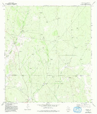
Arid grazing lands and deep brush country define this landscape in the early 1970s, as seen along the boundary between Jim Hogg and Starr Counties. This survey documents a rural ranching economy dependent on subterranean water, evidenced by a dense network of named windmills such as the Filipino Windmill, Agua Buena Windmill, and the clustered Ebanito Windmills. Small outposts of activity are found at Cuevitas, which includes a local Cem, and San Roman near the southern border. The hydrology of the area is marked by ephemeral drainage systems like Largo Creek and the long Cañada Honda, which flow into the Charco de Remadura and Sandia Creek during seasonal rains. This map provides a detailed record of the South Texas rangeland before modern development, capturing the specific locations of family-run ranch infrastructure, including oil wells and the pipeline traversing the southern terrain.
Find a feature on this map
39 named features on this map. Tap any name to fly to it.
Don’t see what you’re looking for? This feature index may not catch every label — zoom into the map to look around manually.
Map Details
Editions of this 1972 Cuevitas Map
2 editions found
Other maps of this area

1938 · El Sauz
USGS Topo · 1:62,500

1938 · Agua Nueva
USGS Topo · 1:62,500

1938 · Sal Colorada
USGS Topo · 1:62,500

1938 · Cuevitas
USGS Topo · 1:62,500

1949 · Mc Allen
USGS Topo · 1:250,000

1954 · McAllen
USGS Topo · 1:250,000

1957 · Mc Allen
USGS Topo · 1:250,000

1962 · McAllen
USGS Topo · 1:250,000
1972 · Guerra
USGS Topo · 1:24,000
1972 · Viboras
USGS Topo · 1:24,000