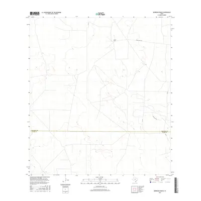
2016 Map of Borregos Ranch
USGS Topo · Published 2016About this map
Borregos Ranch sits at the heart of this South Texas landscape, marking a remote settlement pattern defined by large ranching tracts and isolated road networks. The terrain is bifurcated by the prominent administrative boundary of the Jim Hogg Co / Starr Co line, illustrating the division of this sparsely populated brushland. Primary access through the region is maintained by FM 1017, which connects the ranching outposts to larger thoroughfares. The local economy and geography are further revealed through named tracks like Borregos Ranch Rd and Rancho Viejo Rd, which trace the paths between established homesteads and grazing lands. This survey provides a clear view of the sparse infrastructure and large-scale land divisions characteristic of the Rio Grande Plain in the early 21st century.
Find a feature on this map
5 named features on this map. Tap any name to fly to it.
Don’t see what you’re looking for? This feature index may not catch every label — zoom into the map to look around manually.
Map Details
Editions of this 2016 Borregos Ranch Map
This is the sole edition of this map. No revisions or reprints were ever made.
Other maps of this area

1938 · El Sauz
USGS Topo · 1:62,500

1938 · Agua Nueva
USGS Topo · 1:62,500

1938 · Sal Colorada
USGS Topo · 1:62,500

1938 · Cuevitas
USGS Topo · 1:62,500

1949 · Mc Allen
USGS Topo · 1:250,000

1954 · McAllen
USGS Topo · 1:250,000

1957 · Mc Allen
USGS Topo · 1:250,000

1962 · McAllen
USGS Topo · 1:250,000

1972 · Cuevitas
USGS Topo · 1:24,000
1972 · Viboras
USGS Topo · 1:24,000