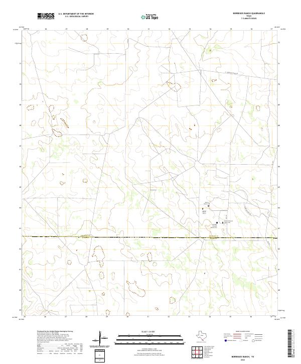
2022 Map of Borregos Ranch
USGS Topo · Published 2022About this map
Private family legacy and ranching history characterize this South Texas landscape where the Jim Hogg Co and Starr Co boundary line bisects the brush country. The map highlights a series of small, significant burial grounds concentrated east of FM 1017, including the Santiago Olivarez Family Cem and the Fermin Olivarez Junior Cem. These landmarks suggest long-standing generational ties to the land in an area defined by large ranching operations. Modern transport routes like Borregos Ranch Rd and Rancho Viejo Rd provide the primary access through this sparsely populated territory, while several Aurora Ranch Cem sites further attest to the localized history of the region's prominent ranching estates.
Find a feature on this map
8 named features on this map. Tap any name to fly to it.
Don’t see what you’re looking for? This feature index may not catch every label — zoom into the map to look around manually.
Map Details
Editions of this 2022 Borregos Ranch Map
This is the sole edition of this map. No revisions or reprints were ever made.
Other maps of this area

1938 · El Sauz
USGS Topo · 1:62,500

1938 · Agua Nueva
USGS Topo · 1:62,500

1938 · Sal Colorada
USGS Topo · 1:62,500

1938 · Cuevitas
USGS Topo · 1:62,500

1949 · Mc Allen
USGS Topo · 1:250,000

1954 · McAllen
USGS Topo · 1:250,000

1957 · Mc Allen
USGS Topo · 1:250,000

1962 · McAllen
USGS Topo · 1:250,000

1972 · Cuevitas
USGS Topo · 1:24,000
1972 · Viboras
USGS Topo · 1:24,000