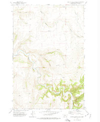
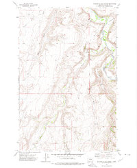
1971 Map of Boston Coulee School
USGS Topo · Published 1974About this map
The Smith River carves a deep, winding path through this portion of Cascade County, creating a dramatic canyon landscape defined by sharp elevation changes and numerous coulees. During the early 1970s, this area remained largely rural, characterized by expansive ranching or agricultural tracts separated by drainage features like Murphy Coulee and Rocky Coulee. The presence of the Boston Coulee School near the center of the sheet indicates the historical importance of localized education centers for the scattered families living along the river breaks. A single Prospect located near Chicken Coulee hints at the geological exploration common in this terrain, while numerous unnamed Spring labels suggest the vital importance of natural water sources for sustaining life and livestock in the semi-arid Montana high country.
Find a feature on this map
11 named features on this map. Tap any name to fly to it.
Don’t see what you’re looking for? This feature index may not catch every label — zoom into the map to look around manually.
Map Details
Editions of this 1971 Boston Coulee School Map
This is the sole edition of this map. No revisions or reprints were ever made.
Other maps of this area

1886 · Great Falls
USGS Topo · 1:250,000

1954 · Great Falls
USGS Topo · 1:250,000

1955 · Stockett
USGS Topo · 1:62,500

1955 · Gore Hill
USGS Topo · 1:62,500

1957 · Great Falls
USGS Topo · 1:250,000

1965 · Eden
USGS Topo · 1:24,000
1965 · Stockett
USGS Topo · 1:24,000
1965 · Truly
USGS Topo · 1:24,000
1971 · Deep Creek Park
USGS Topo · 1:24,000
1971 · Spanish Coulee School
USGS Topo · 1:24,000