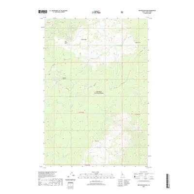
2020 Map of Boston Mountain
USGS Topo · Published 2020About this map
Boston Mtn and its surrounding drainage basins dominate this high-altitude landscape within the Nez Perce National Forest. The 2020 topography illustrates the intricate network of alpine waterways, including the headwaters of Big Mallard Creek and its tributary, South Fork Big Mallard Creek, which carve deep canyons into the central Idaho terrain. To the south, Boston Mountain Lake sits in a high-elevation basin, while Mountain Meadows and Soda Creek Point mark the varying elevations of the northern reaches.
Find a feature on this map
24 named features on this map. Tap any name to fly to it.
Don’t see what you’re looking for? This feature index may not catch every label — zoom into the map to look around manually.
Map Details
Editions of this 2020 Boston Mountain Map
This is the sole edition of this map. No revisions or reprints were ever made.
Other maps of this area

1956 · Elk City
USGS Topo · 1:250,000

1960 · Elk City
USGS Topo · 1:250,000

1966 · Green Mtn.
USGS Topo · 1:24,000

1966 · Black Hawk Mtn
USGS Topo · 1:24,000

1966 · Sable Hill
USGS Topo · 1:24,000

1977 · Boston Mtn
USGS Topo · 1:24,000

1978 · Spread Creek Point
USGS Topo · 1:24,000

1978 · Hida Point
USGS Topo · 1:24,000

1978 · Sheep Hill
USGS Topo · 1:24,000

1978 · Trapper Creek
USGS Topo · 1:24,000