
Loading...
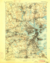
Loading map...1943 Map of Boston
USGS Topo · Published 1943About this map
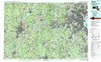
The Navy Yard and various coastal defenses like Fort Independence anchor the maritime landscape of Boston Harbor during the second World War. This wartime survey by the Corps of Engineers, U.S. Army illustrates a region in mid-century transition, where established academic centers like Wellesley College and Weston College sit adjacent to growing transit hubs like the Commonwealth Airport.
Find a feature on this map
226 named features on this map. Tap any name to fly to it.
Don’t see what you’re looking for? This feature index may not catch every label — zoom into the map to look around manually.
Map Details
Date Portrayed1943
Date Published1943
PublisherU.S. Geological Survey
Map TypeTopographic
Scale1:125000
Physical Dimensions15.9 x 21 inches
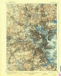
Editions of this 1943 Boston Map
This is the sole edition of this map. No revisions or reprints were ever made.
Historical Maps of Hyde Park Through Time
9 maps found


Featured Locations
Source Details
SourceU.S. Geological Survey
CopyrightPublic Domain