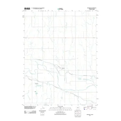
2011 Map of Bostwick
USGS Topo · Published 2011About this map
Bostwick sits at the heart of this Republican River Valley landscape, where the interplay of natural waterways and managed irrigation defines the geography. The wide course of the Republican River is paralleled by the extensive reach of the Superior Canal and the Courtland Canal, systems that have long supported the region's agricultural productivity. To the south, the Johnston and Thompson Reservoir and Gibson Reservoir are held by their respective namesake dams, Johnston and Thompson Dam and Gibson Dam, illustrating the significant mid-century water management infrastructure in Nuckolls County. Numerous drainages such as Cottonwood Creek, Sand Creek, and Oak Creek feed into the river basin, creating a complex network of creeks that once dictated early settlement patterns and property lines.
Find a feature on this map
17 named features on this map. Tap any name to fly to it.
Don’t see what you’re looking for? This feature index may not catch every label — zoom into the map to look around manually.
Map Details
Editions of this 2011 Bostwick Map
This is the sole edition of this map. No revisions or reprints were ever made.
Other maps of this area

1894 · Mankato
USGS Topo · 1:125,000

1898 · Superior
USGS Topo · 1:125,000

1955 · Grand Island
USGS Topo · 1:250,000

1955 · Beloit
USGS Topo · 1:250,000

1957 · Grand Island
USGS Topo · 1:250,000

1958 · Grand Island
USGS Topo · 1:250,000

1959 · Beloit
USGS Topo · 1:250,000
1969 · North Branch
USGS Topo · 1:24,000
1969 · Mankato NW
USGS Topo · 1:24,000
1969 · Webber
USGS Topo · 1:24,000