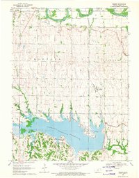
1969 Map of Webber
USGS Topo · Published 1971About this map
Lovewell Reservoir dominates the southern landscape of this Jewell County survey, created by the damming of White Rock Creek. This artificial lake provides the central focus for public lands including Lovewell State Park, the Oak Hill Recreation Area, and the Cedar Point Recreation Area. North of the reservoir, the small settlement of Webber is positioned along the Atchison Topeka and Santa Fe railroad line, serving as a local hub amidst the high-relief terrain of Montana and Jackson townships.
Find a feature on this map
28 named features on this map. Tap any name to fly to it.
Don’t see what you’re looking for? This feature index may not catch every label — zoom into the map to look around manually.
Map Details
Editions of this 1969 Webber Map
This is the sole edition of this map. No revisions or reprints were ever made.
Other maps of this area

1892 · Concordia
USGS Topo · 1:125,000

1894 · Mankato
USGS Topo · 1:125,000

1898 · Superior
USGS Topo · 1:125,000

1898 · Hebron
USGS Topo · 1:125,000

1955 · Manhattan
USGS Topo · 1:250,000

1955 · Lincoln
USGS Topo · 1:250,000

1955 · Grand Island
USGS Topo · 1:250,000

1955 · Beloit
USGS Topo · 1:250,000

1956 · Manhattan
USGS Topo · 1:250,000

1957 · Manhattan
USGS Topo · 1:250,000