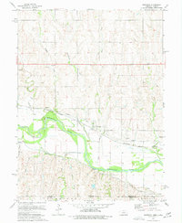
1974 Map of Bostwick
USGS Topo · Published 1977About this map
The Republican River valley defines this landscape along the border of Nuckolls County, Nebraska, and Jewell County, Kansas, in the mid-1970s. The settlement of Bostwick sits north of the river, positioned between the Burlington Northern railroad line and the waterway. This area shows a highly managed water system designed for agriculture, evidenced by the extensive paths of the Courtland Canal and Superior Canal which parallel the river's winding course.
Find a feature on this map
21 named features on this map. Tap any name to fly to it.
Don’t see what you’re looking for? This feature index may not catch every label — zoom into the map to look around manually.
Map Details
Editions of this 1974 Bostwick Map
This is the sole edition of this map. No revisions or reprints were ever made.
Other maps of this area

1894 · Mankato
USGS Topo · 1:125,000

1898 · Superior
USGS Topo · 1:125,000

1955 · Grand Island
USGS Topo · 1:250,000

1955 · Beloit
USGS Topo · 1:250,000

1957 · Grand Island
USGS Topo · 1:250,000

1958 · Grand Island
USGS Topo · 1:250,000

1959 · Beloit
USGS Topo · 1:250,000
1969 · North Branch
USGS Topo · 1:24,000
1969 · Mankato NW
USGS Topo · 1:24,000
1969 · Webber
USGS Topo · 1:24,000