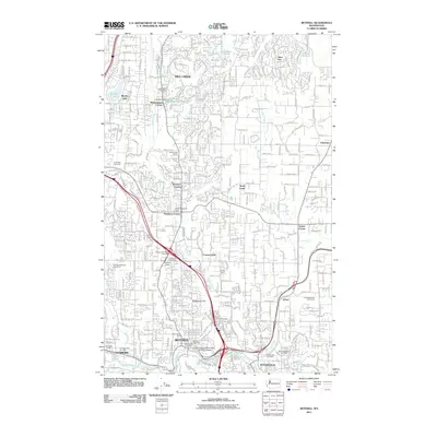
2011 Map of Bothell
USGS Topo · Published 2011About this map
Bothell and the surrounding Snohomish and King County suburbs are depicted here during a period of significant regional infrastructure development. The map highlights a landscape transitioning from historical rural crossroads like Wintermutes Corner, Kennard Corner, and Thrashers Corner into a modern residential and commercial hub. The convergence of North Creek and Bear Creek near the Sammamish River anchors the drainage of the area, while the University of Washington-Bothell Campus and numerous park-and-ride facilities signal the area's role as a major educational and transit corridor.
Find a feature on this map
45 named features on this map. Tap any name to fly to it.
Don’t see what you’re looking for? This feature index may not catch every label — zoom into the map to look around manually.
Map Details
Editions of this 2011 Bothell Map
This is the sole edition of this map. No revisions or reprints were ever made.
Other maps of this area

1894 · Seattle
USGS Topo · 1:62,500

1895 · Snohomish
USGS Topo · 1:125,000

1897 · Seattle
USGS Topo · 1:125,000

1908 · Seattle
USGS Topo · 1:62,500

1909 · Seattle Special
USGS Topo · 1:62,500

1942 · Edmonds
USGS Topo · 1:62,500

1944 · Everett
USGS Topo · 1:62,500

1949 · Seattle North
USGS Topo · 1:24,000

1950 · Redmond
USGS Topo · 1:24,000

1950 · Kirkland
USGS Topo · 1:24,000