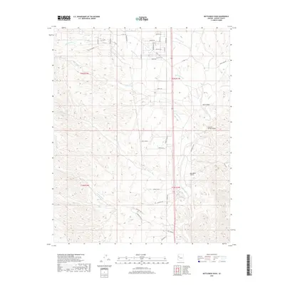
2018 Map of Bottleneck Wash
USGS Topo · Published 2018About this map
Bottleneck Wash serves as the namesake for this arid Mohave County landscape, where an intricate network of drainage channels defines the topography. The terrain is marked by deep geographic features like Round Valley and Dripping Springs Canyon, while Row Water Canyon cuts through the southeastern reach. A series of residential and rural tracks, such as Windmill Ranch Road and Mountain Lion Road, suggests the modern expansion of ranching or remote homesites into these canyonlands. The map reveals a high concentration of named washes, including Kabba Wash, McGarrys Wash, and Wheeler Wash, illustrating the seasonal water patterns essential to this high desert environment. Local transit is supported by County Highway 141 and County Highway 193, providing access between these isolated valleys and canyons.
Find a feature on this map
46 named features on this map. Tap any name to fly to it.
Don’t see what you’re looking for? This feature index may not catch every label — zoom into the map to look around manually.
Map Details
Editions of this 2018 Bottleneck Wash Map
This is the sole edition of this map. No revisions or reprints were ever made.
Other maps of this area

1886 · Diamond Creek
USGS Topo · 1:250,000

1892 · Diamond Creek
USGS Topo · 1:250,000

1923 · Signal
USGS Topo · 1:250,000

1942 · Signal
USGS Topo · 1:250,000

1948 · Williams
USGS Topo · 1:250,000

1950 · Prescott
USGS Topo · 1:250,000

1954 · Prescott
USGS Topo · 1:250,000

1954 · Williams
USGS Topo · 1:250,000

1956 · Williams
USGS Topo · 1:250,000

1958 · Prescott
USGS Topo · 1:250,000