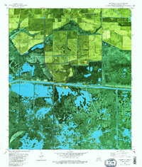
1982 Map of Boudreaux Lake
USGS Topo · Published 1982About this map
Gibbstown serves as a small terrestrial anchor in this 1982 orthophotomap of the Louisiana wetlands, where the Intracoastal Waterway cuts a sharp horizontal line through the marsh. To the north, the landscape is partitioned by an organized network of elevated roads and the North Canal, while the southern half dissolves into the complex hydrologic systems of Boudreaux Lake and Broussard Lake. This map captures a transition in land use, showing the tension between natural marshland and industrial activity, evidenced by a Drill Hole and Oil Tanks near Savane Neuville Island. For genealogists, the inclusion of Granger Cem in the northern agricultural section provides a specific point of reference for families settled in this part of Cameron Parish. The orthophoto base reveals the intricate texture of the wetland vegetation and the precise paths of a Pipeline crossing the northern interior.
Find a feature on this map
11 named features on this map. Tap any name to fly to it.
Don’t see what you’re looking for? This feature index may not catch every label — zoom into the map to look around manually.
Map Details
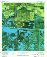
Editions of this 1982 Boudreaux Lake Map
2 editions found
Other maps of this area

1932 · Lake Charles SW
USGS Topo · 1:31,680

1932 · Lake Charles SE
USGS Topo · 1:31,680

1934 · Lake Misere
USGS Topo · 1:24,000

1934 · Sweet Lake
USGS Topo · 1:24,000

1934 · Grand Bayou
USGS Topo · 1:24,000

1934 · Boudreaux Lake
USGS Topo · 1:24,000

1935 · Sweet Lake
USGS Topo · 1:31,680

1935 · Lake Misere
USGS Topo · 1:31,680

1935 · Boudreaux Lake
USGS Topo · 1:31,680

1935 · Grand Bayou
USGS Topo · 1:31,680