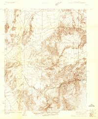
1926 Map of Boulder Canyon
USGS Topo · Published 1926About this map
The Colorado River carves through the heart of the Southwest in this 1926 survey, documenting the landscape immediately before the construction of Hoover Dam transformed the region forever. Several proposed locations for river management are noted, including the Boulder Canyon Dam Site, the Callville Dam Site, and the Upper Black Canyon Dam Site. These markers highlight a pivotal moment when federal and municipal agencies were actively engineering the river's future.
Find a feature on this map
26 named features on this map. Tap any name to fly to it.
Don’t see what you’re looking for? This feature index may not catch every label — zoom into the map to look around manually.
Map Details
Editions of this 1926 Boulder Canyon Map
2 editions found

Other maps of this area

1886 · Camp Mohave
USGS Topo · 1:250,000

1886 · Saint Thomas
USGS Topo · 1:250,000

1892 · Camp Mohave
USGS Topo · 1:250,000

1893 · Saint Thomas
USGS Topo · 1:250,000

1907 · Las Vegas
USGS Topo · 1:250,000

1908 · Las Vegas
USGS Topo · 1:250,000

1910 · Ivanpah
USGS Topo · 1:250,000

1912 · Ivanpah
USGS Topo · 1:250,000

1926 · Nelson
USGS Topo · 1:96,000

1926 · Bonelli
USGS Topo · 1:96,000