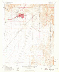
1958 Map of Boulder City
USGS Topo · Published 1959About this map
Boulder City stands as a focal point of infrastructure and recreation during the late 1950s, serving as a gateway to the Lake Mead National Recreation Area. The map reveals a town built upon government necessity, featuring the U S Government RR and the Union Pacific rail lines that once supported regional development. Local civic life is anchored by Memorial Park, a High School, and essential utilities like the Filtration Plant and Sewage Disposal facility. To the west, the Boulder City Airport occupies the flat expanse of the El Dorado Valley, while the surrounding terrain is defined by the El Dorado Mountains and drainage features such as Hemenway Wash and Bootleg Wash. This survey captures the structured transition from a federal company town into a municipal recreation hub, evidenced by the large Boulder City Municipal Recreation Area boundary.
Find a feature on this map
28 named features on this map. Tap any name to fly to it.
Don’t see what you’re looking for? This feature index may not catch every label — zoom into the map to look around manually.
Map Details
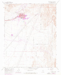
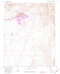
Editions of this 1958 Boulder City Map
Other maps of this area

1886 · Camp Mohave
USGS Topo · 1:250,000

1886 · Saint Thomas
USGS Topo · 1:250,000

1892 · Camp Mohave
USGS Topo · 1:250,000

1893 · Saint Thomas
USGS Topo · 1:250,000

1926 · Nelson
USGS Topo · 1:96,000

1926 · Boulder Canyon
USGS Topo · 1:96,000

1942 · Camp Mohave
USGS Topo · 1:250,000

1947 · Kingman
USGS Topo · 1:250,000

1948 · Kingman
USGS Topo · 1:250,000

1952 · Henderson
USGS Topo · 1:62,500