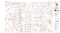
1983 Map of Boulder City
USGS Topo · Published 1983About this map
Boulder City stands as the primary hub in this desert landscape, situated near the western edge of the Lake Mead National Recreation Area. The Colorado River carves a deep path through the center of the sheet, separating the Eldorado Mountains in Nevada from the Black Mountains in Arizona. This 1980s-era map documents a region defined by its mid-century mining legacy and the burgeoning recreation economy around the river.
Find a feature on this map
66 named features on this map. Tap any name to fly to it.
Don’t see what you’re looking for? This feature index may not catch every label — zoom into the map to look around manually.
Map Details
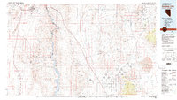
Editions of this 1983 Boulder City Map
2 editions found
Other maps of this area

1886 · Diamond Creek
USGS Topo · 1:250,000

1886 · Camp Mohave
USGS Topo · 1:250,000

1886 · Saint Thomas
USGS Topo · 1:250,000

1886 · Mt. Trumbull
USGS Topo · 1:250,000

1892 · Diamond Creek
USGS Topo · 1:250,000

1892 · Mt. Trumbull
USGS Topo · 1:250,000

1892 · Camp Mohave
USGS Topo · 1:250,000

1893 · Saint Thomas
USGS Topo · 1:250,000

1907 · Las Vegas
USGS Topo · 1:250,000

1908 · Las Vegas
USGS Topo · 1:250,000