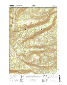
2017 Map of Boulder Lake
USGS Topo · Published 2017About this map
Boulder Lake and its surrounding high-elevation waters define this 2017 survey at the intersection of Marion, Wasco, and Jefferson counties. The landscape is characterized by a complex network of glacial and volcanic landforms, from the distinctive Cinder Cone and Lookout Butte to the riparian flats of Boulder Creek Meadows and Cedar Meadow. A dense grid of Bureau of Indian Affairs and forest roads, such as Bia RD 33 and NW Trout Lake RD, provides access to these alpine water bodies, including Trout Lake, Blue Lake, and Island Lake. The southern portion of the map is dominated by the headwaters of Shitike Cr, which flows eastward through the tribal lands. This record captures the modern infrastructure of a resource-rich mountain environment, preserved as a baseline for environmental and recreational study within the Cascade Range.
Find a feature on this map
56 named features on this map. Tap any name to fly to it.
Don’t see what you’re looking for? This feature index may not catch every label — zoom into the map to look around manually.
Map Details
Editions of this 2017 Boulder Lake Map
This is the sole edition of this map. No revisions or reprints were ever made.
Other maps of this area

1927 · Mt. Jefferson
USGS Topo · 1:125,000

1930 · Mt. Jefferson
USGS Topo · 1:125,000

1955 · Bend
USGS Topo · 1:250,000

1957 · Bend
USGS Topo · 1:250,000

1958 · Bend
USGS Topo · 1:250,000

1961 · Whitewater River
USGS Topo · 1:62,500

1961 · Fort Butte
USGS Topo · 1:62,500
1961 · Mt. Jefferson
USGS Topo · 1:62,500
1961 · Breitenbush Hot Springs
USGS Topo · 1:62,500
1983 · Madras
USGS Topo · 1:100,000