
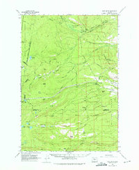
1961 Map of Fort Butte
USGS Topo · Published 1963About this map
The Warm Springs River and its numerous tributaries, including Badger Creek and Mill Creek, define the water-rich landscape of this central Oregon territory. In the early 1960s, this area reflects a mix of remote wilderness and resource management, evidenced by the presence of the Old Mill Camp and a small Airstrip near Sawmill Butte. Grazing and land use are marked by named areas such as Schoolie Pasture and Peters Pasture, while the topography is punctuated by prominent volcanic features like Fort Butte, Badger Butte, and the Sidwalter Buttes. The high-elevation terrain is further characterized by numerous small lakes and meadows, including Trout Lake, Blue Lake, and Cedar Meadow. A network of primitive routes, such as the Skyline Trail and the Bypass Trail, provide access through the Mount Hood National Forest, highlighting the area's legacy as a site for both industry and backcountry travel.
Find a feature on this map
42 named features on this map. Tap any name to fly to it.
Don’t see what you’re looking for? This feature index may not catch every label — zoom into the map to look around manually.
Map Details
Editions of this 1961 Fort Butte Map
2 editions found
Other maps of this area

1924 · Mount Hood
USGS Topo · 1:125,000

1927 · Mount Hood
USGS Topo · 1:125,000

1927 · Mt. Jefferson
USGS Topo · 1:125,000

1928 · Madras
USGS Topo · 1:125,000

1930 · Mt. Jefferson
USGS Topo · 1:125,000

1930 · Dufur
USGS Topo · 1:125,000

1931 · Madras
USGS Topo · 1:125,000

1934 · Dufur
USGS Topo · 1:125,000

1953 · The Dalles
USGS Topo · 1:250,000

1955 · Bend
USGS Topo · 1:250,000